
Is the Northern GR20 Right for a Beginner?
The GR20 crosses Corsica's mountains from Calenzana in the north-west to Conca in the south-east. In total it is around 180 kilometres with roughly 12,000 metres of ascent, and it is widely described as one of the toughest long-distance trails in Europe. It divides naturally at Vizzavona, roughly halfway, where the railway between Ajaccio and Bastia crosses the mountains.
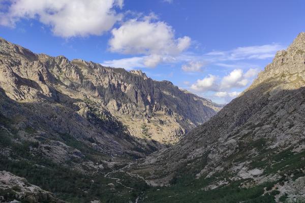
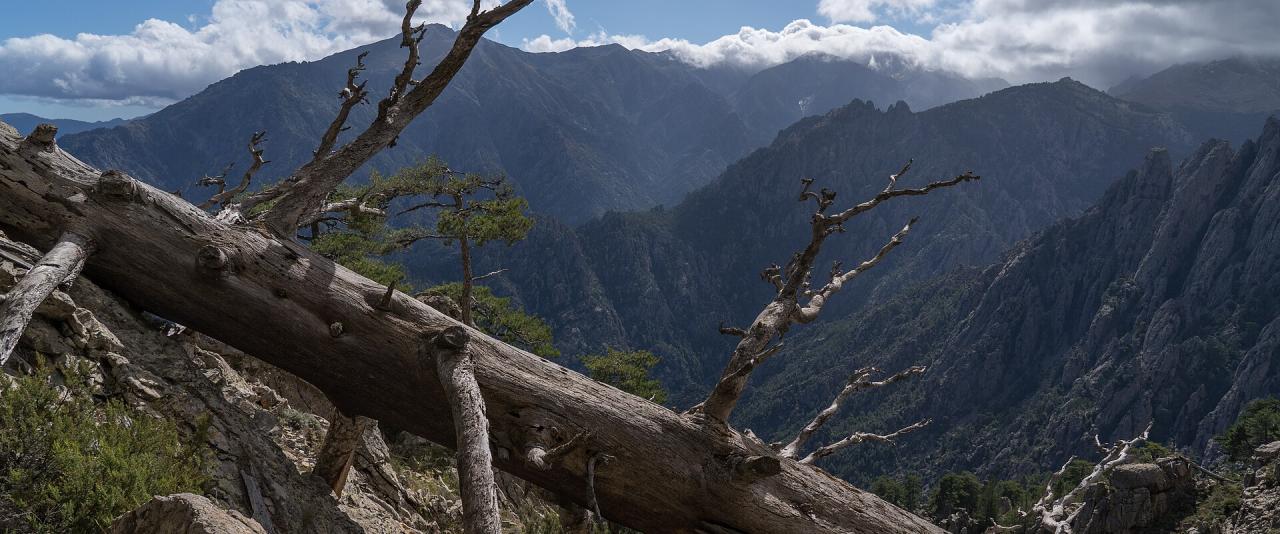
The northern half, from Calenzana to Vizzavona, is the steeper, rockier and more alpine of the two. It has long sections of scrambling on bare granite, fixed chains in places, steep descents on loose ground and very little shade. A beginner can complete it, but only with good fitness, previous experience of multi-day hiking with a pack, and a willingness to turn back or bail out if conditions are bad. If you have never hiked in the mountains, consider starting with the southern half or with day walks from Vizzavona or the Restonica valley.
The Stages, Calenzana to Vizzavona
A common division into nine stages, with approximate figures:
- Calenzana to Ortu di u Piobbu – about 11 km, 1,450 m of ascent. A long, hot climb from the village; the refuge burned down in 2019 and facilities there have been more basic since, so check the current situation.
- Ortu di u Piobbu to Carrozzu – about 8 km, a rough and slow stage with plenty of scrambling.
- Carrozzu to Ascu Stagnu – about 9 km, crossing the Spasimata suspension bridge before climbing and descending to the old ski station at Haut-Asco, which has a road.
- Ascu Stagnu to Tighjettu – about 9 km and around 1,200 m of ascent, one of the hardest days. The route used to pass through the Cirque de la Solitude, but after rockfall the standard path has been diverted onto a high alpine variant near Monte Cinto, Corsica's highest peak.
- Tighjettu to Ciottulu di i Mori – a short stage of around 7 km.
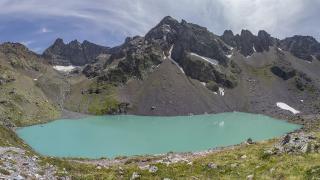
- Ciottulu di i Mori to Manganu – around 24 km in total, usually split at Castel di Vergio, a road pass with a hotel, and passing the Lac de Ninu, a high mountain lake surrounded by grassy meadows.
- Manganu to Petra Piana – about 8.5 km, including the high ridge above the Capitellu and Melu lakes.
- Petra Piana to Onda – about 10 km, with a choice between the valley route and a higher ridge variant.
- Onda to Vizzavona – about 10.5 km, finishing with a long descent through forest to the village and its railway station.
Walking times of six to eight hours a day are typical. Many hikers take ten or more days for this half to allow rest days and bad weather.
Getting There and Getting Out
Calenzana is about 12 km from Calvi, which has an airport, a ferry port and a railway station; buses and taxis connect the two. At the other end, Vizzavona station has trains towards Ajaccio and Bastia.
Three points on the northern half are reachable by road, which makes them useful places to start, finish early or leave the trail if needed: Ascu Stagnu (Haut-Asco), Castel di Vergio and Vizzavona itself. A beginner who wants a shorter first experience can walk from Castel di Vergio to Vizzavona, which avoids the most exposed northern sections.
Refuges, Booking and Camping
The trail is served by mountain refuges run by the Parc naturel régional de Corse, plus a few private gîtes and hotels at road passes. Refuges are staffed in the main summer season, when you can buy meals and basic supplies, and they fill up quickly. Bed and tent pitch reservations are made through the park's online reservation centre, and booking well ahead is strongly advised for July and August. Wild camping away from the designated areas around refuges is not allowed.
When to Go
The usual hiking season is from June to September. In early June snow can linger on the high passes and north-facing slopes of the northern section, sometimes requiring extra equipment. July and August are hot and busy. Late August and September bring fewer people but a higher chance of thunderstorms, which build quickly in the afternoon in Corsica's mountains. Start each day early and aim to cross high ground before midday.
What a Beginner Should Prepare
- Fitness: train with long hill walks carrying a loaded pack, including steep descents.
- Pack weight: keep it light, since a heavy pack makes scrambling harder and less safe. Use refuge meals where possible instead of carrying all your food.
- Footwear: boots or sturdy trail shoes with good grip on rock; break them in before you go.
- Water: carry at least two litres, as water sources can be far apart and some dry up in late summer.
- Navigation: the route is marked with red-and-white waymarks, but carry a map or offline map app and check the weather forecast every evening.
- Insurance: make sure your travel insurance covers mountain hiking and rescue.
The northern GR20 is hard, but it rewards preparation with remarkable high-mountain scenery. Taking it slowly, splitting long stages and knowing your bail-out points are the most useful decisions a first-timer can make.